Rockbridge State Nature Preserve protects Ohio’s largest natural bridge in the Hocking Hills region. Reach the sandstone arch on a wooded hike with hills; add the Rock Shelter Trail if your group wants a longer outing.
Before you choose this hike
- Admission and parking: Free for a regular trail visit.
- Visit length: Allow about 1½–2 hours for the bridge outing as a planning estimate, with extra time for the rock shelter or a slower pace.
- Terrain and access: Uneven natural trail and climbs; not a wheelchair or stroller route.
- Facilities: Plan a restroom stop before arrival and bring drinking water. Neither is listed for Rockbridge in Ohio DNR’s preserve guide.
- Pets: Pet dogs are not allowed, even on a leash. Service animals are permitted under Ohio DNR’s preserve policy.
How far is the walk to the natural bridge?
Start at the Dalton Road parking area, waypoint A on the official Rockbridge trail map. The approach to junction B is 0.5 mile each way. Continue on the orange Bridge Trail toward C and the bridge-side spur toward D, then return through the loop to B and retrace the approach to your car.
| Outing | Planning distance | Route and return |
|---|---|---|
| Bridge Trail with its full riverside spur | About 1.8 miles total | A–B–C–D–C–E–B–A. D is the mapped canoe-access point near the bridge; return from the spur to C. |
| Add the Rock Shelter Trail | About 2.6 miles total | At E, follow the blue trail to F, complete its small loop, and return to E before heading back through B to A. |
These approximate totals are added from the map’s rounded segment labels and include the full C–D spur and the approach in both directions. Explore Hocking Hills describes the overall trail system as 2.75 miles; it is not all required to visit the bridge. Follow current trail signs.
Do you have to walk down to the river to see the bridge?
No. Follow the signed bridge spur from C to see the natural bridge; the canoe landing at D is an optional continuation toward the Hocking River. Turn back after viewing the bridge if you do not want the riverside extension. The totals above include the full spur to D, so a bridge visit without the landing is shorter.
Plan your arrival
Parking: 11475 Dalton Road, Rockbridge, OH 43149. Use the designated trailhead spaces. If they are full, return later or choose another outing rather than using neighboring private land.
Hours: Ohio DNR’s statewide preserve guide describes daily dawn-to-dusk access. Check posted hours and current notices, and leave enough daylight for the return hike.
Check the destination: Rockbridge is the natural arch on Dalton Road. Rock House is a different destination in Hocking Hills State Park, with a tunnel-like sandstone chamber and a separate trailhead.
Our family tip: download your map before you go. Cell reception can be unreliable in Hocking Hills. We learned this the hard way: download an offline Google map while you still have Wi-Fi or a cell signal. Download an area that covers your whole drive, including the way back to where you are staying, and wait for the download to finish. Simply saving a place or opening directions is not the same as downloading an offline map. How to download a Google map for offline use. Offline maps support driving directions within the downloaded area; live traffic and walking directions are unavailable offline. Save the official trail map before you leave so it is available offline during your hike.
Before setting out, check the National Weather Service forecast for Rockbridge and ODNR park information and notices. Weather and trail conditions can change; check posted notices at your destination too.
Get directions and estimated drive time on Google Maps. Choose your current location or enter a starting address to see the route to Rockbridge State Nature Preserve.
Terrain, children and mobility
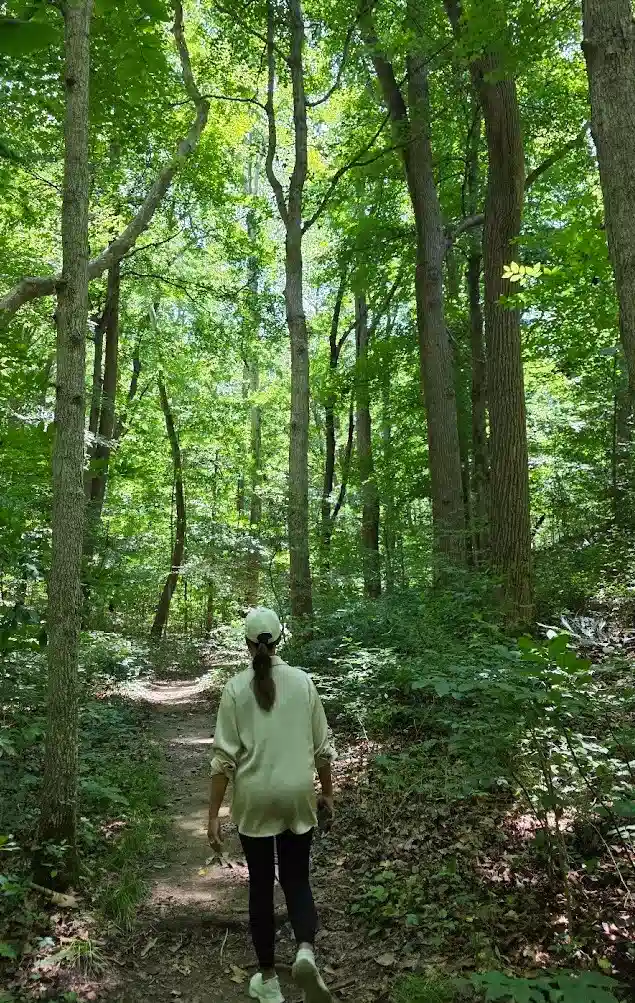
Expect roots, rocks and changes in elevation. The approach has to be climbed or descended again on the return; reaching the bridge is only part of the walk. Mud, wet rock and winter ice can make the footing harder.
With children: Choose this hike for children who can manage uneven ground and follow directions near the ravine. Keep them close at exposed edges and stay on the signed trail. If anyone needs a level paved outing, compare our Ash Cave guide and accessible Hocking Hills guide.
For a stroller, wheelchair or someone who finds hills difficult, choose another stop. A short mileage figure does not describe the effort of this terrain.
What to bring and when to go
- Hiking shoes with grip, water, and a weather-appropriate layer.
- Bug protection in warmer weather; spare socks and clothes for children after a muddy walk.
- The saved trail map and enough phone battery for your return directions.
Check the forecast before deciding. After rain, expect more difficult footing; in freezing weather, ice can change whether the outing suits your group. A weekday morning is a reasonable planning preference, with no guarantee of an empty lot or trail. Pack out what you bring.
What makes the bridge worth the hike?
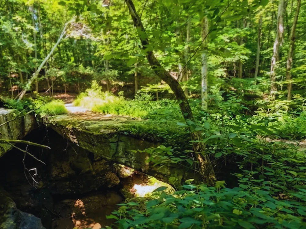
The Ohio Geological Survey’s Rockbridge guide describes the bridge as 92 feet long and about 40 feet above the ravine. Water eroded softer Black Hand Sandstone beneath a more resistant upper layer, leaving the arch. Look at the opening and rock layers from the marked trail.
Can you walk across the natural bridge?
Yes—the local tourism association describes walking across it. Follow the marked route and current signs; do not cross if access is closed. Expect exposed edges and potentially muddy or slippery footing. Keep children close, and view the formation from the marked trail if crossing does not suit your group.
Choosing another stop or a place to stay
For a paved approach, compare Ash Cave or the paved portion of Conkle’s Hollow Gorge Trail. For more hike choices, use our Hocking Hills trail comparison. Check terrain and parking for the next stop before setting off.
Choose lodging by the drive from its actual address, your sleeping arrangements and any access needs. Pool House Lodge is in McArthur; use current directions to compare the drive rather than assuming every Hocking Hills property is equally close.
More visitor questions
Do you need an advance access permit to hike Rockbridge?
Rockbridge is not on Ohio DNR’s list of preserves requiring an advance access permit for an ordinary marked-trail visit. Leaving designated trails requires a separate permit. Check current preserve notices before going.
Can you reach Rockbridge from the Hocking River?
Yes. Ohio DNR’s map marks canoe access at waypoint D near the bridge. If you plan to arrive by canoe or kayak, check river conditions and confirm the route, landing and return arrangements with your outfitter before booking. The hiking parking area is on Dalton Road.
Plan your stay at Pool House Lodge
See the lodge layout and amenities and specific access features and limits, then check dates for your group.
Check AvailabilityOriginally published .