A family’s view of the trail
A short hike can still ask a lot of your feet.
We’ve walked Old Man’s Cave as a family. Ton filmed while Jim and Fyn explored the gorge, and the things that stand out in our footage are the things we’d want another family to see before going: stone stairs, roots underfoot, a narrow tunnel, and sandstone walls that feel enormous beside a person.
This guide pairs that firsthand look with practical planning. Use it to think about your own group’s pace, footing and comfort with steps—not just the number of miles on a map.
What the trail actually looks like
A short visual overview can show what a trail rating cannot: the size of a step, the width of a passage and the surface under your shoes. Follow those details from the walk beneath the overhangs to the rock passages and water in the gorge.
Music: “Carefree” by Kevin MacLeod, licensed under CC BY 4.0. Excerpt trimmed, volume adjusted and fades added.
What you’ll see in the gorge
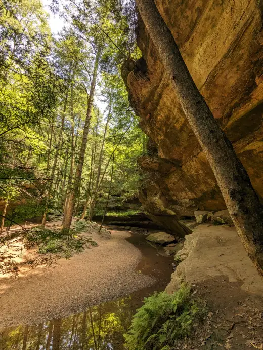
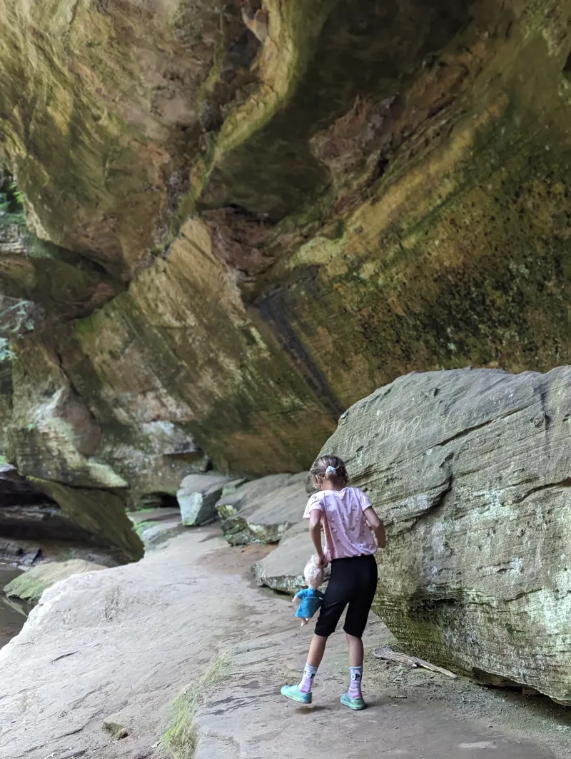
Our photos show layered sandstone, deep overhangs, forest above the rock walls and water moving through the gorge. People in the frame help show the scale: a wall that looks impressive on its own becomes much easier to understand with someone standing beneath it.
Look for the smaller details too—the texture of the stone, exposed roots and light filtering through the trees. Water flow changes, so a waterfall in someone else’s photograph is not a promise of what you’ll find.
How difficult does “moderate” feel?
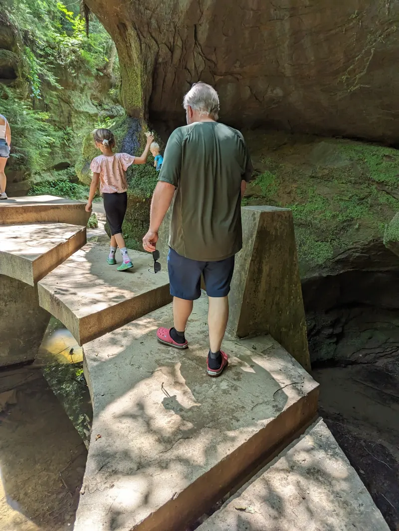
The useful question is what your group can comfortably manage. In our footage, the terrain changes between dirt paths, stonework, roots and steps. Even where the distance is short, each change can affect your pace.
| What we can show | What to consider |
|---|---|
| Stair flights and individual steps | Comfort going down as well as climbing back up. |
| Roots and embedded rocks | Balance and careful foot placement on irregular ground. |
| A low, narrow tunnel | Headroom, passage width and space around a backpack. |
| Changing surfaces | Shoes with grip and time to walk at the slowest person’s pace. |
There is no simple stair-count test that guarantees a comfortable hike. Plan the entire route, including the exit, before heading down into the gorge.
Roots, rock and narrow passages
One of Ton’s walking clips looks directly at exposed roots and stones in the path. Another follows Jim into a narrow rock tunnel. These are useful views when deciding how the hike might feel with your footwear, balance or pack.
Stay on the designated route and follow posted directions. Look for the signed path rather than assuming that a worn patch of rock is the way forward.
Watch the trail overview above for a close view of the roots and narrow rock passage.
Visiting Old Man’s Cave with kids
We’ve done this walk as a family, and Fyn in the footage gives you a child’s scale beside the sandstone and steps. That is more useful than a blanket “kid-friendly” label. Your child’s stamina, confidence on uneven ground and ability to stay close all matter.
- Leave enough energy for the return climb.
- Keep children close at steps, narrow sections and edges.
- Bring water and shoes with grip.
- Choose a route that suits the whole group; the gorge is not a stroller walk.
For a gentler outing, compare the options in our Ash Cave guide and Hocking Hills with kids guide.
Grandparents, knees and mobility
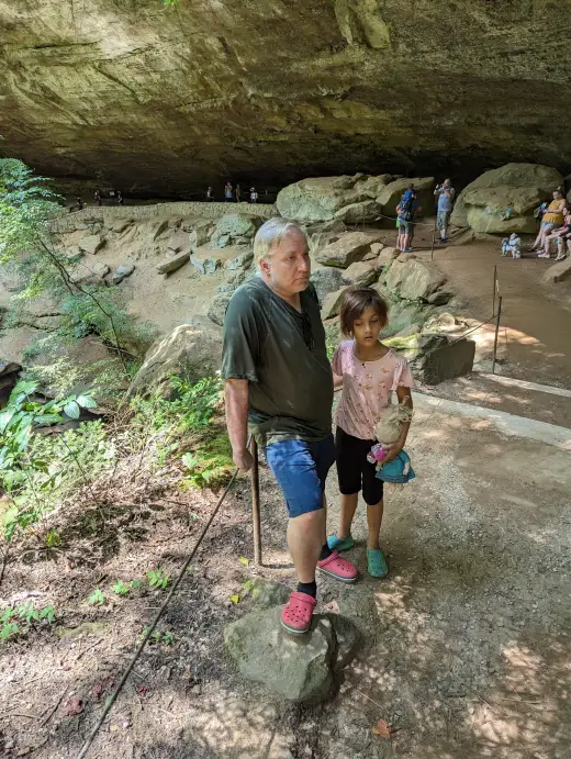
Age alone does not tell you whether this is a good fit. Talk about comfort descending steps, balance on irregular ground, low passages and the climb out. Someone who enjoys a level walk may find those demands quite different.
The gorge route shown here includes stairs and is not a step-free route. Ask park staff about current accessible paths and facilities outside the gorge, and about an outing that fits the least comfortable walker in your group. If you split up, agree on a meeting place before setting off.
Compare options in our grandparents guide and accessible Hocking Hills guide. The stair and terrain views above are there to help that conversation.
Choose the route before you start
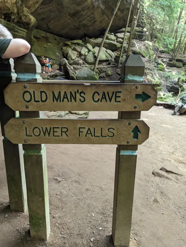
Old Man’s Cave connects to a wider trail network. A walk focused on this gorge and a longer outing toward Cedar Falls are different plans. Check your intended exit, distance and return route on the official ODNR trail map.
Parking, arrival and restrooms
The Old Man’s Cave visitor-center and parking area is on State Route 664. Before leaving the lot, look at the trailhead map and notices, choose your route and check where it exits. Plan a restroom stop before heading into the gorge.
Confirm current visitor-center hours, restroom availability and any parking or trail restrictions through park information before your trip. Leave time to get oriented before starting the walk.
Plan your arrival
Our family tip: download your map before you go. Cell reception can be unreliable in Hocking Hills. We learned this the hard way: download an offline Google map while you still have Wi-Fi or a cell signal. Download an area that covers your whole drive, including the way back to where you are staying, and wait for the download to finish. Simply saving a place or opening directions is not the same as downloading an offline map. How to download a Google map for offline use. Offline maps support driving directions within the downloaded area; live traffic and walking directions are unavailable offline. Save the official trail map before you leave so it is available offline during your hike.
Before setting out, check the National Weather Service forecast for South Bloomingville and ODNR park information and notices. Weather and trail conditions can change; check posted notices at your destination too.
Get directions and estimated drive time on Google Maps. Choose your current location or enter your starting address to see the route and estimated driving time to the Old Man’s Cave visitor center. Follow signs for visitor parking on arrival.
For the walk itself, use the official ODNR trail map to check trail entrances, directions and exits.
What to bring and when to go
Wear shoes with grip, bring water and keep a copy of the trail map available. Bring spare socks and a change of clothes for children in case of rain, mud or accidental splashes. Give the group time to stop without turning the outing into a race to the next attraction. If you want more space for photographs and a slower pace, consider an early weekday visit rather than a busy weekend.
Check weather and ODNR park information and notices before setting out. Wet rock changes the footing; thunder, flooding or ice can change the decision entirely. Our rainy day guide offers alternatives when a gorge walk does not suit the conditions.
Build a day around your group’s energy
You do not need to fit every gorge into one day. Compare Ash Cave and Conkle’s Hollow, or use our complete Hocking Hills guide to plan a mix of walking and downtime.
Old Man’s Cave questions
Where do you park for Old Man’s Cave?
Start at the Old Man’s Cave visitor-center and parking area on State Route 664. Check the official ODNR trail map for the trail entrance, your intended route and its exit before entering the gorge. Follow current parking signs; if the lot is full, follow staff directions and use only designated parking. See ODNR park information for directions and current notices.
How long is the Old Man’s Cave hike?
The distance depends on the route and exit you choose. A walk around Old Man’s Cave is different from following connecting trails toward Cedar Falls or Ash Cave. Use the official trail map to plan the complete walk, including the climb out and return to your vehicle.
How much time should we allow at Old Man’s Cave?
For planning, set aside about 1–2 hours for a visit focused on Old Man’s Cave, with extra time for children, rests and photographs. This is a planning allowance, not a guaranteed walking time; the regional tourism association’s sample itinerary allows 1½ hours for a one-mile hike. Longer connecting routes need additional time. Choose your route on the ODNR trail map before setting out.
Do you need tickets, reservations or a guided tour for Old Man’s Cave?
No admission ticket or paid guided tour is needed for an ordinary self-guided day hike. Admission is free, and regular day hiking generally does not require an advance reservation. Camping, private tours and special activities have separate arrangements. See the regional visitor FAQ and day-hike reservation guidance; check ODNR notices before traveling.
What time does Old Man’s Cave open and close?
ODNR lists Hocking Hills State Park hours as half an hour before sunrise to half an hour after sunset. Plan to finish your hike before dark and follow any posted trail closures. Visitor-center hours are separate. Check the official ODNR hours and park information before your trip.
Are dogs allowed at Old Man’s Cave?
Yes, dogs are allowed on the Old Man’s Cave trail. Keep your dog on a six-foot leash, clean up after it and consider whether it can manage stairs, narrow passages and nearby hikers. The same pet rules do not apply to every nearby nature preserve. See the Old Man’s Cave visitor guide and ODNR pet and trail guidelines.
Are there stairs at Old Man’s Cave?
Yes. Our footage shows a stair flight, individual stone steps, exposed roots and uneven ground. The short distance does not make the gorge a level walk.
Is Old Man’s Cave good for kids?
We’ve walked it as a family. Consider your child’s stamina, ability to manage steps and willingness to stay close. Our family’s experience does not guarantee the same fit for every child. The gorge route is not a stroller walk.
Can grandparents enjoy Old Man’s Cave?
Age alone does not decide the fit. Consider stairs in both directions, balance on uneven ground and energy for the return climb. Ask park staff about current options before committing to the gorge.
Is the gorge trail wheelchair accessible?
The gorge route shown here includes stairs and uneven ground and is not a step-free route. Ask park staff about current accessible facilities and paths outside the gorge, and consult our accessible Hocking Hills guide when comparing outings.
Can we simply turn around if the hike feels too long?
Do not assume so. The official trail map marks one-way sections. Follow the posted direction and signed exits; ask park staff about a shorter option before you start.
Can you hike from Old Man’s Cave to Cedar Falls and Ash Cave?
Yes, connecting trails link these areas, but this is a longer outing than a visit focused on Old Man’s Cave. Check distances, one-way sections, signed exits and the return journey on the official ODNR trail map. Plan how everyone will get back to the starting point before committing to the longer route.
Our experience and official planning information
The family observations here come from Ton’s footage and photographs of the walk with Jim and Fyn. They show the terrain we encountered; they are not a live conditions report. Consult the ODNR trail map and Hocking Hills State Park information for trip planning, and follow current on-site notices.
This guide is by the Pool House Family. Explore our Hocking Hills travel guides for more practical trip-planning information.
Originally published .